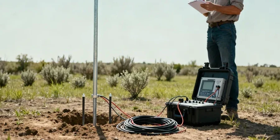
On the limestone terrain stretching from the Castlecomer Plateau down to the River Nore, we consistently encounter subsurface conditions that demand more than just a standard borehole. Kilkenny's geology, shaped by Carboniferous limestone with significant overburden, often masks solution features that can compromise a project's foundation. The electrical resistivity survey, particularly the Vertical Electrical Sounding method, lets us map these variations in depth without turning a single sod. By injecting a controlled current and measuring the potential difference, we build a geoelectric profile that distinguishes between saturated clays, competent rock, and potential voids. When a developer near the Medieval Mile suspects buried services or a soft zone beneath glacial till, the MASW survey complements the resistivity data by adding a shear-wave velocity dimension, while a test pit offers direct visual confirmation of the topmost strata.
A single VES sounding can delineate the bedrock topography beneath 30 metres of glacial drift in less than two hours on site.
Local geotechnical context
With a population approaching 27,000 and Kilkenny's designation as a key growth centre under the National Planning Framework, pressure on greenfield and infill sites is mounting. The greatest risk we see isn't the geology itself, it's the assumption that a desk study will catch every karst feature. A collapsed solution pipe in the Waulsortian limestone can swallow a foundation overnight, and its resistivity signature is unmistakable if you run the right survey grid. Skipping the geophysics means betting the project budget against a void that a single percussion borehole might miss entirely. We also have to consider the seasonal groundwater fluctuation: a VES run in September after a dry summer will show higher apparent resistivities than one run in February when the water table is at its peak, directly affecting the interpreted bearing stratum.
Relevant standards
I.S. EN 1997-2:2007 (Eurocode 7 – Ground investigation and testing, including geophysical methods), BS 5930:2015+A1:2020 (Code of practice for ground investigations, with guidance on resistivity applications), I.S. EN ISO 22475-1:2021 (Geotechnical investigation and testing – Sampling methods and groundwater measurements), ASTM D6431-18 (Standard Guide for Using the Direct Current Resistivity Method for Subsurface Investigation – applied under Irish conditions), TII (Transport Infrastructure Ireland) Specification for Ground Investigation
Frequently asked questions
How much does a VES survey cost in Kilkenny?
For a standard Vertical Electrical Sounding or a short 2D resistivity line around the city and county, you can expect a fee ranging from €600 to €870. The final figure depends on the number of soundings, the maximum depth required (which dictates cable layout and crew time), and the complexity of the terrain. A multi-line tomography grid for a commercial site will exceed this range, and we provide a fixed-price proposal after reviewing the site plan.
How deep can an electrical resistivity survey see beneath Kilkenny's soil?
With a Schlumberger array, the rule of thumb is that the depth of investigation reaches about one-third to one-quarter of the maximum current electrode spacing. Using an AB/2 of 150 metres, we can reliably image down to 40 or 50 metres, which is more than enough to pass through the glacial drift and into the competent limestone bedrock that underlies most of the city.
Can resistivity identify exactly where a limestone cavity is?
It identifies the high-resistivity anomaly that an air-filled void creates, or a low-resistivity zone if the cavity is filled with saturated clay. The precise geometry requires a dense 2D tomography grid and calibration with a borehole or dynamic probe. The method tells us where to drill, not that you can skip the drilling entirely.
What is the difference between a VES and a 2D resistivity imaging survey?
A VES gives you a vertical profile of resistivity directly beneath a single point, assuming horizontal layering. It is fast and ideal for depth-to-rock soundings. A 2D Electrical Resistivity Tomography line strings out dozens of electrodes and images a vertical cross-section, showing both vertical and lateral changes. We use VES for reconnaissance and 2D ERT when we suspect lateral heterogeneity, like a buried channel or an irregular karst surface.